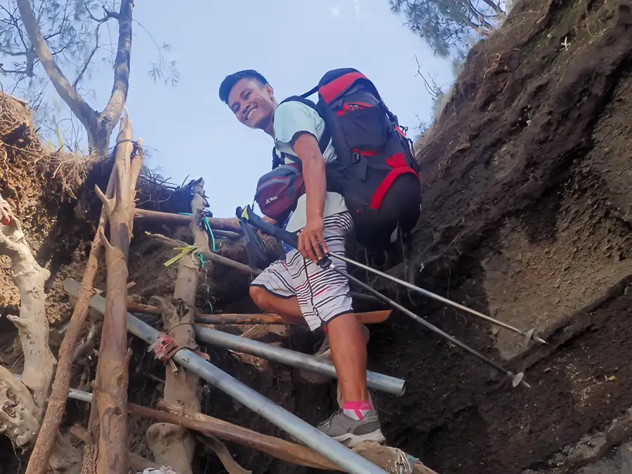
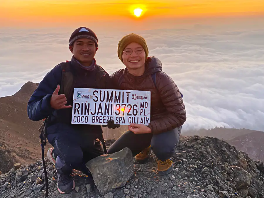
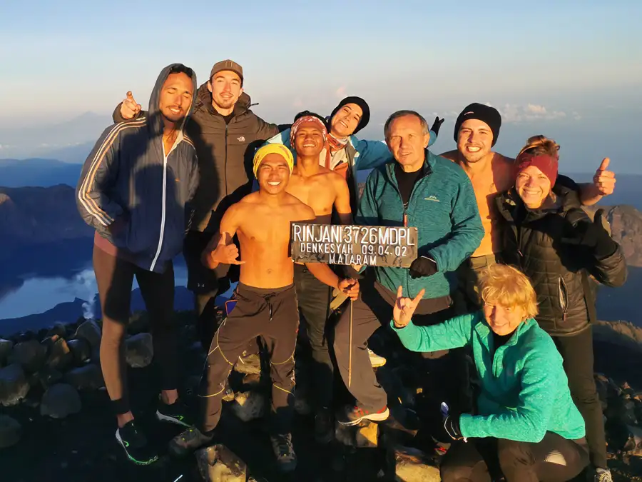
Mt. Rinjani Trekking Organizer Since 1991

Home

About Us

Cars

Hotels

Flight

Travel Tips

Site Map


Might to See

Should to Know

Environment

Villages

Trek to Brings

Trek Equipment

Deluxe Service

Budget Service

Standards Service

Sembalun Route

Senaru Route

Torean Route

Timbanuh Route

Baby Volcano Program

Summit Program

Lake Program

Crater Rim Program

Europe Packages

Asia Packages

American Packages

Indonesian Packages


Rinjani Trekking


Our Site Network

Travel to Lombok island

Wisata Ke Pulau Lombok

Lombok Rent Car


Mt. Rinjani Lombok Trekking Information


Welcome to Mt. Rinjani Lombok Trekking Club & Center Organizer Information, Rinjani Lombok Trekking Guide, Rinjani Lombok Trekking Travel Agent, We provide all information about climbing and trek to mount Rinjani volcano Lombok island Indonesia Asia. And service with safe, fun, exception, and help you to finding unforgettable an experience in your life time at the excellent nature of adventure.
 

Mt. Rinjani 3726 M


A prestigious 2004 World Legacy Award for environmental and social leaders in tourism was given to the Rinjani Trek Management Board by Conservation International (CI) and National Geographic Traveler magazine, in a ceremony at the National Geographic Society in Washington DC on 8 June 2004. The Rinjani Trek in Gunung Rinjani National Park in Lombok Indonesia was the winner of the Destination Stewardship Award, selected as a tourism destination that best demonstrates effective protection of its natural and cultural environment.

The Rinjani Trek was lauded in the award citation as “a place doing superb work in protecting its overall natural and cultural heritage, the volcanic heart of the island of Lombok, Indonesia”. Visitors to this tropical island enjoy long jungle treks to the awe-inspiring crater valley, waterfalls and hot springs, and emerge from the forest canopy to enjoy an amazing panoramic ocean view.

The Rinjani program is exemplary for its strong partnership among local community groups, tourism industry and national park, and has successfully withstood the recent deep dip in Indonesia’s tourism.


Mount Rinjani or Gunung Rinjani is an active volcano in Indonesia on the island of Lombok. It rises to 3,726 m (12,224 ft), making it the third highest volcano in Indonesia. The first historical eruption occurred in September 1847. The most recent eruption of Mount Rinjani was on 10 May 2009. The volcano had started erupting again on 27 April 2009, and the mountain was closed as the eruptions intensified with plumes of smoke and ash as high as 8,000 m.


The 6 km by 8.5 km oval-shaped caldera is filled partially by a crater lake known as Segara Anak ('Child of the Sea') and is approximately 2000m above sea level and estimated at being around 200m deep) the caldera also contains hot springs. The eruptions of 1994, 1995, and 1996 have formed a small cone, Gunung Baru (or 'New Mountain' - approximately 2300m above sea level) in the center of the caldera and lava flows from these eruptions have entered the lake. This cone has since been renamed Mount Barujari (or 'New Finger').

The highlands are forest clad and mostly underdeveloped. The lowlands are highly cultivated. Rice, soybeans, coffee, tobacco, cotton, cinnamon, and vanilla are the major crops grown in the fertile soils of the island.

The volcano and the caldera are protected by a national park established in 1997. Tourism is increasingly popular with trekkers able to visit the rim, make their way into the caldera or even to make the more arduous climb to the highest point fatalities, however, are not uncommon.


The Rinjani mountain is the second highest peak active volcano in Indonesia and absolutely a challenging mountain walk and you must be prepared with good equipment, warm and windproof clothing if you want to make adventure trekking to the summit of rinjani mountain 3726 m. Trekking to Rinjani mountain lombok Indonesia can attract severe storms, lightening and strong winds. When the weather is settled, the sun is intense and the nights frosty. Parts of the trail are steep and slippery.

Beware of bad weather and risks of exposure to the wet and cold (hypothermia). If caught in an electrical storm, take shelter and avoid prominent ridges. Beware of snakes, and stinging insects and plants. Leeches can be a nuisance in the wet season.
 

Geography

Elevation : 3,726 metres (12,224 feet)
Location : Lombok, Indonesia
Prominence : 3,726 m
Coordinates : 8°25'S, 116°28'E
Type : Stratovolcano (active)
Eruption : 2004


Erupted History
The June 1994 eruption. At 02:00 pm, on June 3rd, 1994, Barujari come began erupting by sending an ash plume 500 m high. On June 8th, press report described emission of "smoldering lava" and "thick smoke", as well as ash fall in nearby villages from an ash cloud rising 1,500 m above the summit. Between 3rd and 10th of June, up to 172 explosions could be heard each day from the Sembalun Lawang volcano observatory (15 km NE). During this period, seismic data indicated a dramatic increase in the number of explosions per day, from 68 to 18,720. Eruptions were continuous at least through 19th of June, with maximum ash plume heights of 2,000 m on 9th to 11th.

The ash plume generally drifted SE, depositing up to 30 mm of ash on the island. Strombolian eruptions ejected pyro clastic material > 2m in size as high as 600 m above the vent; this material fell in a restricted proximal area around the cone and in the lake. Lava flows began on 8th of June and partially covered previous lava flows from Rombongan (in 1944) and Barujari (in 1966).

A series of aircraft warnings based on pilot reports and weather satellite images indicated much larger plumes than suggested by the ground observations. First an eruption at about 12:00 on June 7th produced a long plume that caused a large number of aviation warnings. The plume, located on satellite imagery, extended 120 km S of Rinjani and was beginning to disperse by 15:30. A pilot report at 16:45 indicated a "smoke" plume to 13,500 m altitude moving ESE, but by 23:45 the plume was in distinguish- able on satellite imagery. The imagery showed a plume around 06:33 on the 8th of June, which extended at least 83 km SE of the volcano. Aircraft were advised to avoid this area to an altitude of 10,500 m. above sea level.


Have Enjoy a Trek and Good Luck..!!!


Free web hostingWeb hosting


LOMBOK TRAVEL ONLINE

Holiday Made Easy

Jl. Raya Senggigi Km. 12 Lombok - West Nusa Tenggara - Indonesia

Ph: +62(0)370-6677886 - Fax : +62(0)370-693950 - SMS : +62(0)85.339.530.005

Email :lomboktravel@gmail.com

Copyright : Lombok Travel Online  - powered by 000webhost.com - Design W@yne

ASITA